Submit Post
Date: August 14, 2026 10:13 am. Number of posts: 5,044. Number of users: 3,636.

Lagos Traffic Update: Live Sources and Route Guide

The fastest way to get a live Lagos traffic update right now is to combine two channels: tune to Lagos Traffic Radio 96.1FM for corridor-specific incident reports, then open Google Maps or Waze to check your exact route’s ETA. Confirm any unusual closure or major incident against LASTMA’s official social feeds before committing to a detour. The Naijatipsland community forum also carries eyewitness posts that add ground-level color when official bulletins are slow to update.

Three steps to take right now:

  • Check Lagos Traffic Radio 96.1FM for timestamped corridor bulletins — look for “flash update” labels, which signal a sudden road event requiring immediate attention.
  • Open Google Maps or Waze and enter your origin and destination to see live ETA and incident pins.
  • Scan LASTMA’s official X (Twitter) feed or Facebook page for any major closure or emergency advisory on your corridor.

Always check the timestamp on any report before acting on it. A bulletin posted more than 30 minutes ago may no longer reflect current conditions, especially during peak hours when Lagos road situations shift quickly.


Key Takeaways

The most reliable Lagos traffic update strategy combines Lagos Traffic Radio 96.1FM for corridor-specific incident alerts with Google Maps or Waze for live rerouting, confirmed against LASTMA’s official feeds for major closures.

PointDetails
Top live sourcesLagos Traffic Radio 96.1FM and Google Maps/Waze together give the fastest, most reliable picture of current conditions.
Timestamp verificationAlways check the time on any report — bulletins older than 30 minutes may not reflect current road conditions.
Third Mainland Bridge priorityCheck this corridor first when traveling between the Mainland and Island; incidents there cascade quickly to Carter and Eko bridges.
Incident responseMove to safety, switch on hazard lights, then contact LASTMA, FRSC, or LASEMA depending on the incident type.
Pre-trip habitRun the five-point checklist (radio, map app, LASTMA feed, community posts, alerts) before every peak-hour departure.

Table of Contents

Where can you get live Lagos traffic updates right now?

Speed and reliability vary significantly across sources. Here is how they rank for a Lagos commuter:

  1. Lagos Traffic Radio 96.1FM — The fastest official source for corridor-specific updates. Bulletins cover named axes (Victoria Island–Lekki, Third Mainland Bridge, Alausa–Ikeja) and flag sudden problems as “flash updates” for immediate awareness. Works without mobile data — critical when your network is congested during peak hours.

  2. LASTMA official feeds (X/Facebook) — The Lagos State Traffic Management Authority posts incident advisories and alternation notices. Updates are authoritative but may lag radio by a few minutes during fast-moving incidents.

  3. Google Maps live-traffic layer — Shows real-time congestion coloring and ETA adjustments for your specific route. Requires mobile data. Best used for rerouting decisions rather than incident confirmation.

  4. Waze community reportsWaze’s live map includes user-supplied location pins and timestamps for Lagos corridors, including Third Mainland Bridge. Community reports can surface incidents faster than official channels, but accuracy depends on the number of active users on that corridor at that moment.

  5. Traffic Index — Provides real-time and historical congestion metrics for Lagos, including a city-level congestion index. Most useful for understanding whether today’s conditions are worse than typical, not for turn-by-turn rerouting.

  6. ViaMichelin — Offers real-time traffic news and route-level incident counts for Lagos. A solid secondary confirmation layer if Google Maps and Waze disagree.

  7. Naijatipsland community posts — Local forum contributors post eyewitness accounts of incidents, road closures, and unusual congestion. Use these for ground-level detail, but always confirm with a timestamped official bulletin before planning a long detour.

Practical tip: Use a map app for rerouting decisions and Lagos Traffic Radio or LASTMA feeds to confirm whether an incident is still active. Community posts and app reports can lag official radio bulletins for very recent events, so treat them as supporting signals, not primary sources.


Which corridors cause the most delays in Lagos?

Knowing where to look first saves time. These are the corridors that most frequently disrupt daily commutes, along with their typical incident patterns:

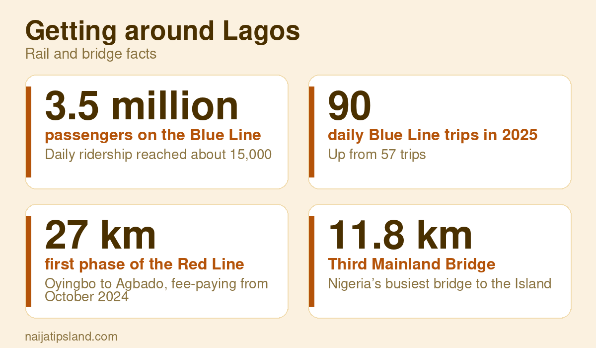
  • Third Mainland Bridge — Lagos’s most sensitive artery. A single breakdown, fire, or failed expansion joint can cascade into gridlock across connected routes within minutes. Past fire incidents involving commercial vehicles have required emergency response from RRS and LASTMA, producing severe delays across the entire bridge. The Federal Government has also ordered the bridge closed to heavy-duty vehicles for structural maintenance, which shifts large truck traffic to alternative routes and changes overall flow patterns. Check this corridor first if you are traveling between the Mainland and the Island.

  • Lekki–Ikoyi/Victoria Island corridor — Prone to severe morning and evening congestion, particularly at the Lekki toll plaza and the Ikoyi Link Bridge. Incidents here ripple back toward Ajah and forward into VI.

  • Ikorodu Road — High volume of BRT buses, commercial vehicles, and motorcycles. Breakdowns and loading-zone blockages are common. Traffic alternation at key junctions adds unpredictable short delays.

  • Lagos–Ibadan Expressway — Heavy-vehicle traffic and ongoing rehabilitation works create frequent lane reductions. Check for official Federal Ministry of Works advisories before using this route for early-morning travel.

  • Oshodi–Ojota axis — One of the busiest interchange zones in Lagos. Market activity, bus terminals, and pedestrian crossings combine to slow traffic throughout the day, not just at peak hours.

  • Alausa–Ikeja — Traffic alternation at Allen Avenue, Toyin Street, and nearby junctions is managed by LASTMA officers. Alternation bulletins from Lagos Traffic Radio are the fastest way to know whether an officer is on ground controlling flow.

  • Lekki–Ajah — Long stretches with limited parallel options. Incidents near the Chevron roundabout or Sangotedo tend to back up traffic several kilometers.

  • Badagry Expressway — Ongoing road rehabilitation works cause lane closures and diversions. Check for Lagos State Government advisories before using this route.

Pro Tip: If you are leaving the Island toward the Mainland, check Third Mainland Bridge status first — always. A bridge closure or major incident there forces you onto Carter Bridge or Eko Bridge, both of which fill quickly. Knowing before you reach the bridge gives you time to choose your alternate crossing without being trapped in the backup.


How do you check traffic for your specific route right now?

Follow these steps in order:

  1. Open Google Maps or Waze on your phone and enter your starting point and destination.
  2. Enable the live traffic layer — in Google Maps, tap the layers icon and select “Traffic.” In Waze, traffic is on by default.
  3. Check the ETA and route color — red or dark orange indicates heavy congestion; yellow means moderate slowdowns. Note any incident pins on your route.
  4. Read incident report details — tap any pin to see what was reported, by whom, and when. Waze timestamps user reports, so you can judge how fresh the information is.
  5. If you see a major incident or the ETA has jumped significantly, tune to Lagos Traffic Radio 96.1FM or check LASTMA’s X feed to confirm whether the incident is still active and whether officers are managing it.
  6. Choose your action: delay departure, reroute, or proceed with caution.

App quick tips:

  • Enable background alerts in Waze so it notifies you of incidents on your saved routes before you leave home.
  • Use the “avoid incidents” routing option in both apps to get an automatic detour suggestion.
  • In Waze, check the timestamp on each user report — reports older than 20 minutes on a fast-moving corridor may already be resolved.

When to delay vs. when to reroute: If a major incident (bridge closure, fire, structural emergency) is confirmed via an official bulletin, delay or plan a full alternate route. For a localized breakdown or single-lane blockage, rerouting around it is usually faster than waiting.

No data? Lagos Traffic Radio 96.1FM works entirely without mobile data. Keep it as your fallback for corridor-level awareness when your connection is weak.


What should you do if you hit an incident on the road?

Your immediate priority is safety, then communication.

Safety checklist:

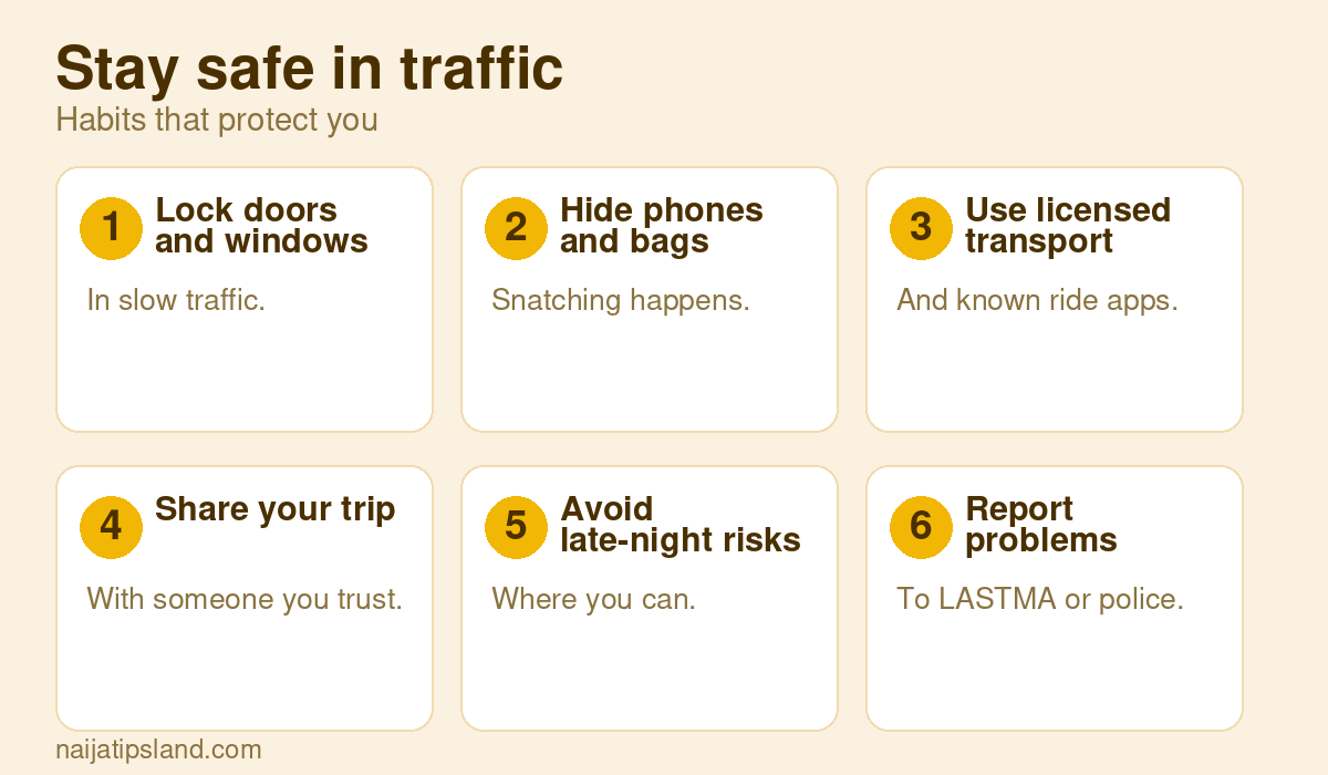
  • Move your vehicle to the shoulder or the nearest safe position off the active lane.
  • Switch on your hazard lights immediately so approaching vehicles can see you.
  • Keep passengers inside the vehicle unless there is a fire or structural danger nearby.
  • Stay visible but away from oncoming traffic.

Who to contact, by incident type:

  • LASTMA — for traffic control and congestion management on state roads. Confirm their current contact number via their official social media pages, as hotlines are periodically updated.
  • FRSC (Federal Road Safety Corps) — for crashes and emergencies on federal highways, including the Lagos–Ibadan Expressway.
  • LASEMA (Lagos State Emergency Management Agency) — for fires, structural collapses, and rescue situations. Lagos has also unveiled a digital platform to improve emergency response coordination, which you can use to report incidents digitally.
  • Police — for security incidents, armed robbery, or situations requiring law enforcement.

When reporting via an app or social feed, include: precise location (nearest landmark or road sign), direction of travel, nature of the hazard, and the time you observed it.

Always check for an official timestamped bulletin before assuming a closure is extended. A social media post without an agency name, date, and time is not a reliable basis for a long detour. LASTMA and Lagos Traffic Radio both label their updates with corridor names and timestamps — use those as your verification standard.


Who manages Lagos traffic and why do planned closures happen?

Four agencies share responsibility for Lagos road management:

  • LASTMA — manages traffic flow on Lagos State roads, deploys officers to alternation points, and issues corridor-specific advisories.
  • FRSC — has jurisdiction over federal roads and highways, including the Lagos–Ibadan Expressway. Handles crash response and road safety enforcement.
  • LASEMA — coordinates emergency response for fires, floods, and structural incidents on any road in the state.
  • Federal Ministry of Works — authorizes and oversees structural maintenance on federal bridges, including the Third Mainland Bridge. Official press releases from this ministry announce planned closures and recommended alternate routes. Past announcements have included 24-hour closures with specific alternate-route guidance.

Planned closures typically happen for four reasons: structural maintenance (bridge deck repairs, expansion joint replacement), heavy-vehicle restrictions for safety, emergency repairs after incidents, and scheduled rehabilitation works on expressways.

The Third Mainland Bridge heavy-vehicle restriction is a structural-safety measure. By keeping large trucks off the bridge, the Federal Government protects the deck from accelerated wear and improves flow for lighter vehicles. Drivers of heavy loads must pre-plan routes through Carter Bridge or alternative crossings. Traffic alternation at key junctions — where LASTMA officers manually control intake — is another routine management tool that causes short, predictable delays at spots like Allen Avenue, Radio junction, and Iganmu.

Timestamped official releases matter because they tell you whether a closure is still active. An undated social media post about a “bridge closure” could be weeks old.


Pre-trip checklist: confirm live traffic before you leave

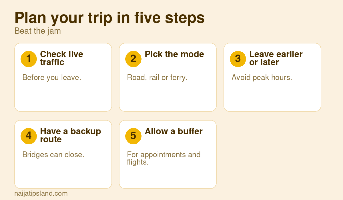
Run through this before every trip during peak periods:

  • Check Lagos Traffic Radio 96.1FM for the latest timestamped bulletin on your corridor.
  • Open Google Maps or Waze and confirm your live ETA and route color.
  • Scan LASTMA’s X or Facebook feed for any active advisory on your specific road.
  • Check Naijatipsland community posts for eyewitness reports on your corridor — especially useful for incidents that broke in the last 10 minutes.
  • Set a Waze alert for your saved route so you receive push notifications before departure.

Pro Tip: Bookmark Lagos Traffic Radio’s website and LASTMA’s X profile on your phone’s home screen. A two-tap check before you leave takes under a minute and can save you 45 minutes in a surprise backup. If you cross a bridge or use an expressway regularly, add a 15-minute buffer on days with rain or public events — those two factors reliably worsen congestion on every major corridor.

Keep a lightweight mobile data plan active for app rerouting. Radio handles the “is there a problem?” question; the map app handles the “how do I go around it?” answer.


A local perspective on commuting in Lagos

Combining radio and a map app is not just a best practice — it is the difference between a 40-minute commute and a two-hour one on a bad day. The radio tells you what is happening; the app tells you what to do about it. Using both together closes the gap that either source leaves on its own.

Light early morning traffic on Lagos bridge

One practical tip that many Lagos commuters overlook: the 6:00 AM to 7:00 AM window is consistently lighter on most corridors than the 7:30 AM to 9:30 AM peak. If your schedule allows a 6:15 AM departure, you will clear Third Mainland Bridge and most Lekki corridor chokepoints before the heaviest volume builds. Evening-wise, leaving the Island after 8:00 PM avoids the worst of the post-work surge. These windows are not guaranteed, but they hold on most weekdays without major incidents.


Sources

Bookmark these and check them in order before any peak-hour trip:

For major closures, always look for an official agency name, corridor label, and timestamp. Any report missing those three elements should be treated as unverified until confirmed by LASTMA, Lagos Traffic Radio, or a government press release.

NTL
We will be happy to hear your thoughts

      Leave a reply

      Nigeria's Fast-Growing Online Forum for News & Discussions
      Logo
      1