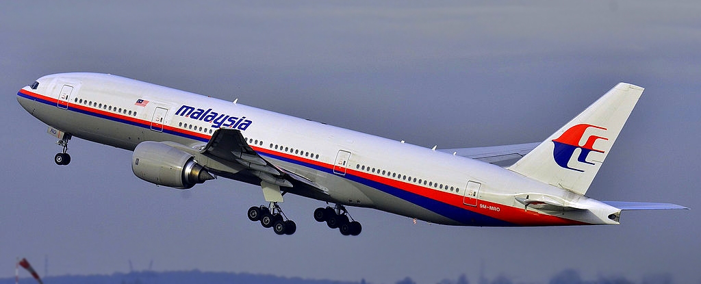
It has been ten years since Malaysia Airlines passenger flight MH370 disappeared on March 8 2014. To this day it remains one of the biggest aviation mysteries globally.
It’s unthinkable that a modern Boeing 777-200ER jetliner with 239 people on board can simply vanish without any explanation. Yet multiple searches in the past decade have still not yielded the main wreckage or the bodies of the victims.
At a remembrance event held earlier this week, the Malaysian transport minister announced a renewed push for another search.
If approved by the Malaysian government, the survey will be conducted by United States seabed exploration firm Ocean Infinity, whose efforts were unsuccessful in 2018.
What happened to MH370?
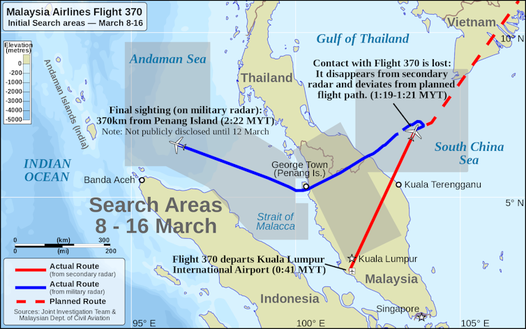
The flight was scheduled to fly from Kuala Lumpur to Beijing. Air traffic control lost contact with the aircraft within 60 minutes into the flight over the South China Sea.
Subsequently, it was tracked by military radar crossing the Malay Peninsula and was last located by radar over the Andaman Sea in the northeastern Indian Ocean.
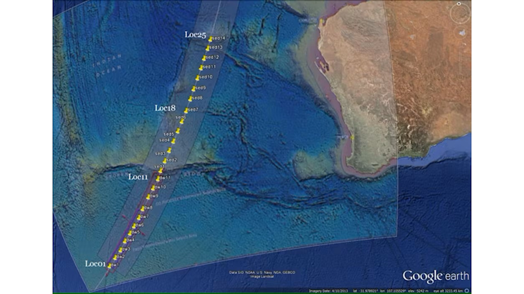
Later, automated satellite communications between the aircraft and British firm’s Inmarsat telecommunications satellite indicated that the plane ended up in the southeast Indian Ocean along the 7th arc (an arc is a series of coordinates).
This became the basis for defining the initial search areas by the Australian Air Transport Safety Bureau. Initial air searches were conducted in the South China Sea and the Andaman Sea.
To date, we still don’t know what caused the aircraft’s change of course and disappearance.
What have searches for MH370 found so far?
On March 18 2014, ten days after the disappearance of MH370, a search in the southern Indian Ocean was led by Australia, with participation of aircraft from several countries. This search continued until April 28 and covered an area of 4,500,000 square kilometres of ocean. No debris was found.
Two underwater searches of the Indian Ocean, 2,800 km off the coast of Western Australia, have also failed to find any evidence of the main crash site.
The initial seabed search, led by Australia, covered 120,000 square kilometres and extended 50 nautical miles across the 7th arc. It took 1,046 days and was suspended on January 17 2017.
A second search by Ocean Infinity in 2018 covered over 112,000 square kilometres. It was completed in just over three months but also didn’t locate the wreckage.
What about debris?
While the main crash site still hasn’t been found, several pieces of debris have washed up in the years since the flight’s disappearance.
In fact, in June 2015 officials from the Australian Air Transport Safety Bureau determined that debris might arrive in Sumatra, contrary to the ocean currents in the region.
The strongest current in the Indian Ocean is the South Equatorial Current. It flows east to west between northern Australia and Madagascar, and debris would be able to cross it.
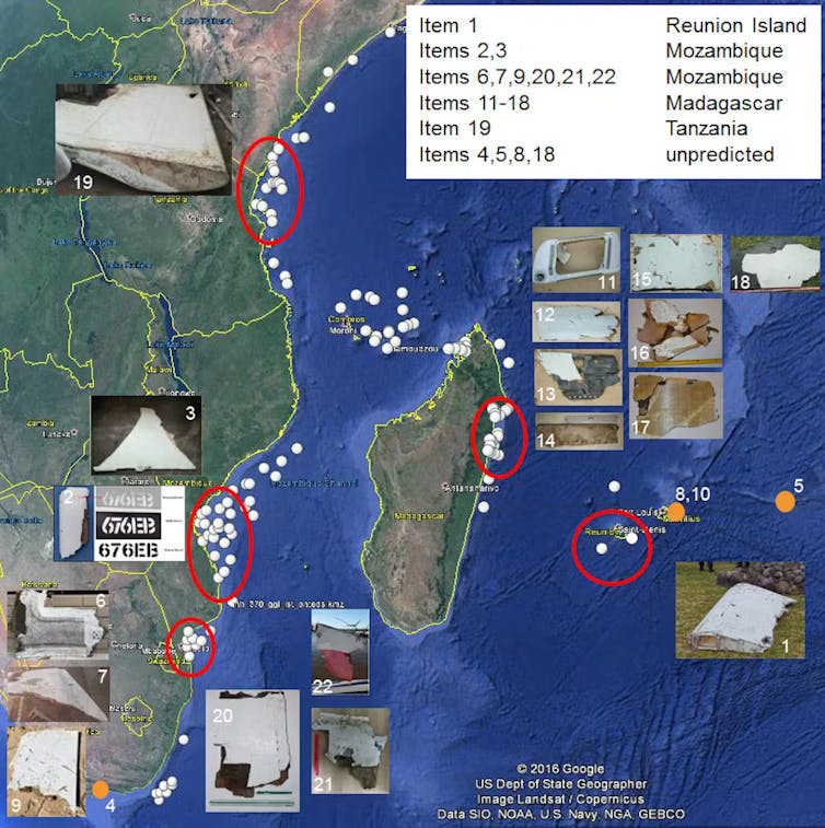
Indeed, on July 30 2015 a large piece of debris – a flaperon (moving part of a plane wing) – washed up on Reunion Island in the western Indian Ocean. It was later confirmed to belong to MH370.
Twelve months earlier, using an oceanographic drift model, our University of Western Australia (UWA) modelling team had predicted that any debris originating from the 7th arc would end up in the western Indian Ocean.
In subsequent months, additional aircraft debris was found in the western Indian Ocean in Mauritius, Tanzania, Rodrigues, Madagascar, Mozambique and South Africa.
The UWA drift analysis accurately predicted where floating debris from MH370 would beach in the western Indian Ocean. It also guided American adventurer Blaine Gibson and others to directly recover several dozen pieces of debris, three of which have been confirmed to be from MH370, while several others are deemed likely.
To date, these debris finds in the western Indian ocean are the only physical evidence found related to MH370.
It is also independent verification that the crash occurred close to the 7th arc, as any debris would initially flow northwards and then to the west, transported by the prevailing ocean currents. These results are consistent with other drift studies undertaken by independent researchers globally.
Why a new search for MH370 now?
Unfortunately, the ocean is a chaotic place, and even oceanographic drift models cannot pinpoint the exact location of the crash site.
The proposed new search by Ocean Infinity has significantly narrowed down the target area within latitudes 36°S and 33°S. This is approximately 50 km to the south of the locations where UWA modelling indicated the release of debris along the 7th arc. If the search does not locate the wreckage, it could be extended north.
Since the initial underwater searches, technology has tremendously improved. Ocean Infinity is using a fleet of autonomous underwater vehicles with improved resolution. The proposed search will also use remotely controlled surface vessels.
In the area where the search is to take place, the ocean is around 4,000 metres deep. The water temperatures are 1–2°C, with low currents. This means that even after ten years, the debris field would be relatively intact.
Therefore, there is a high probability that the wreckage can still be found. If a future search is successful, this would bring closure not just to the families of those who perished, but also the thousands of people who have been involved in the search efforts.![]()
Charitha Pattiaratchi, Professor of Coastal Oceanography, The University of Western Australia
This article is republished from The Conversation under a Creative Commons license. Read the original article.


