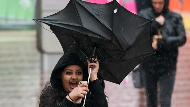
The Met Office has warned of unsettled weather in the UK for the next few days, with the heaviest and most persistent rain set to fall over the weekend when people are celebrating New Year’s Eve
By Minreet Kaur
Snow, flooding and strong winds are forecast for parts of the UK in the run-up to New Year’s Eve, the Met Office has warned.
An amber “danger” to life warning for rain is in force for parts of Scotland until lunchtime on Friday, including an area covering Dumfries, Lockerbie and Thornhill.
Meanwhile, yellow warnings for ice and snow are in force for most of Scotland and Northern Ireland throughout Thursday.
The Met Office has warned of unsettled weather in the UK for the next few days, with the heaviest and most persistent rain set to fall over the weekend when people are celebrating New Year’s Eve. Daytime temperatures for the weekend are forecast to reach around 13°C in the south, 10°C in the north of England and 12°C in Wales.
Daytime temperatures will be between 4°C and 6°C in Scotland, around 6°C in Northern Ireland, according to forecasts.
On Friday, rain will move north-east across the UK and will be heaviest in central and the south-west of Scotland and Northern Ireland. Between 30mm to 60mm of rain could fall in these areas.
The amber rain alert for the south-west of Scotland warns of a “danger to life” from fast flowing or deep floodwater and disruption to trains and buses. It also warns that homes and businesses are likely to be flooded and that some communities could be cut off.
Over high ground in the north of Scotland, up to 10cm of snow is forecast. Strong winds are also expected on Friday, with the coasts of Northern Ireland and western Scotland likely to see gusts of around 60mph.
The Met Office said the wet and windy weather is being pushed on by a strong jet stream, which plays a big role in the country’s weather system.
Although the cyclone and extreme blizzards in North America are not directly impacting the UK’s weather, the temperature contrast across the Atlantic is strengthening the jet stream, leading to a succession of low-pressure systems impacting the UK in the coming days.
Helen Caughey, Met Office Deputy Chief Meteorologist, said: “It’ll be an unsettled New Year weekend for much of the UK, with frequent and at times heavy rain, and a chance this could turn to snow mainly across high ground in Scotland, although there remains a lot of uncertainty where the boundary between the milder and colder air will be.
“New Year’s Eve will be the wetter of the two days, with a number of fronts bringing rain to many areas, especially parts of Scotland as well as south and south-west England, where there will also be some very strong winds along the English Channel.
“What that leaves behind is an unsettled New Year’s Day, with the central and southern parts of the UK likely to see further showers and some longer spells of rain. Further north things are a little more uncertain, but generally a mix of sunshine and showers here, mainly in the east, before conditions look likely to become more widely settled into Monday.”
Further weather warnings could be issued for the weekend when forecasters have established the locations of the worst rainfall.
Next week, the outlook suggests a southeast and northwest split will likely develop, as high pressure clings on to the south, with low pressure to the north.
This is likely to allow for calmer weather further south and more unsettled conditions further north, with showers, some longer spells of rain and strong winds.
However, the details of how this split will materialise remain uncertain, especially with how far south and east any rainfall and strong winds will reach but confidence should improve in the coming days.
Via: INEWS


